


FLINT 1 Voting District, Pike County, Illinois
About
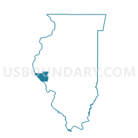
Outline

Summary
| Unique Area Identifier | 573990 |
| Name | FLINT 1 Voting District |
| County | Pike County |
| State | Illinois |
| Area (square miles) | 16.17 |
| Land Area (square miles) | 15.31 |
| Water Area (square miles) | 0.86 |
| % of Land Area | 94.69 |
| % of Water Area | 5.31 |
| Latitude of the Internal Point | 39.71616560 |
| Longtitude of the Internal Point | -90.66853020 |
Maps


Graphs
Select a template below for downloading or customizing gragh for FLINT 1 Voting District, Pike County, Illinois


Neighbors
Neighoring Voting District (by Name) Neighboring Voting District on the Map
- BLOOMFIELD Voting District, Scott County, IL
- CHAMBERSBURG 1 Voting District, Pike County, IL
- DETROIT 1 Voting District, Pike County, IL
- GRIGGSVILLE 1 Voting District, Pike County, IL
- GRIGGSVILLE 2 Voting District, Pike County, IL
- NAPLES-BLUFFS Voting District, Scott County, IL
- NEWBURG 1 Voting District, Pike County, IL
- PERRY 1 Voting District, Pike County, IL
Top 10 Neighboring County Subdivision (by Population) Neighboring County Subdivision on the Map
- Griggsville township, Pike County, IL (1,430)
- Newburg township, Pike County, IL (949)
- Perry township, Pike County, IL (594)
- Naples-Bluffs precinct, Scott County, IL (568)
- Detroit township, Pike County, IL (312)
- Bloomfield precinct, Scott County, IL (298)
- Chambersburg township, Pike County, IL (200)
- Flint township, Pike County, IL (96)
Top 10 Neighboring Place (by Population) Neighboring Place on the Map
Top 10 Neighboring Unified School District (by Population) Neighboring Unified School District on the Map
- Griggsville-Perry Community Unit School District 4, IL (2,456)
- Meredosia-Chambersburg Community Unit School District 11, IL (1,738)
- Scott-Morgan Consolidated Unit School District 2, IL (1,425)
Top 10 Neighboring State Legislative District Lower Chamber (by Population) Neighboring State Legislative District Lower Chamber on the Map
Top 10 Neighboring State Legislative District Upper Chamber (by Population) Neighboring State Legislative District Upper Chamber on the Map
Top 10 Neighboring 111th Congressional District (by Population) Neighboring 111th Congressional District on the Map
Top 10 Neighboring Census Tract (by Population) Neighboring Census Tract on the Map
- Census Tract 9524, Pike County, IL (3,337)
- Census Tract 9528, Pike County, IL (2,492)
- Census Tract 9706, Scott County, IL (1,866)
Top 10 Neighboring 5-Digit ZIP Code Tabulation Area (by Population) Neighboring 5-Digit ZIP Code Tabulation Area on the Map
- 62363, IL (6,353)
- 62694, IL (3,192)
- 62340, IL (1,715)
- 62665, IL (1,629)
- 62621, IL (1,171)
- 62323, IL (290)